Schwarz
View current page
...more recent posts
new gysin book
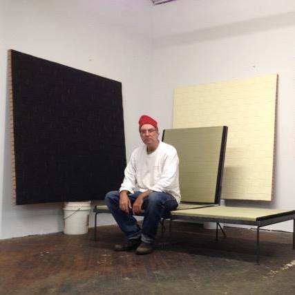
the whole gang is here
japanese cedar tubs
map ur moves
the big uneasy
DLT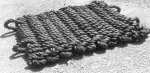
blasters
dynamat
american blasting mats
mazzella blasting mats
best blasting mats
nu-roads blast mats
reliable blast mats
four star blasting mats
Harold Rosenberg Was Not an Art Historian, Catherine Spaeth
More on Harold Rosenberg, Tom Moody
via afc comments
the bakers island ma paradox
also via stdpm
Steely Dan "Any Major Dude" Record Plant Sessions
via stronger than than dirt pete moss fb


cargo net
camo scaffold net jute net long bed more net lift group
self edge (rivington) via rivet head via reference lib
can-can house
Put up or shut up
Boycott Koch Products
Former ELO cellist killed in freak car accident
was crazy for elo in the day. saw them w/ miami cousins summer '73 at wpb sportatorium. edgar winter opened w/ frankenstein tour lineup - via ree
Michel-Étienne Turgot (16901751) was prévôt des marchands de Paris ("Master of the merchants of Paris", i.e. Mayor of Paris) from 1729 to 1740. His name is associated to one of the most famous maps of Paris, the ""Plan de Turgot" or "Plan Turgot", a detailed bird-eye view of Paris realized by Louis Bretez from 1734 to 1739
copy / more paris maps
ladies and germs the rolling stones
museum of useful things
via things mag
how much is enough station to station?

A plume of oil some 700 feet thick and at least 22 miles long has been detected deep beneath the Gulf of Mexico. It originated at the Deepwater Horizon blowout and consists of hydrocarbons from the well, according to measurements released Thursday.
The survey, conducted by US and Australian scientists during a 10-day research cruise in late June, represents the most detailed picture yet of undersea plumes of oil and methane from the Gulf oil spill. The researchers were surprised by the plume's relative stability as well as by an apparent lack of activity on the part of microbes to break down the oil.
The continuous plume appeared some 3,000 feet below the surface, according to data published Thursday afternoon in the journal Science's online outlet, Science Express.
By early May, the researchers were trying to track the progress of the oil spill using existing fluid dynamics models and applying them to aerial and satellite images of the area of the gulf surrounding the spill site. But Mezić says they "were not happy" with the results. So his team incorporated recent equations he had developed into U.S. Naval Research Laboratory ocean-current data. The resulting "visualization software" can reproduce how an oil plume in a given body of water will spread.
The new model revealed that a fluid dispersing within a larger fluidsuch as an oil plume in the oceantends to break into long, thin filaments instead of a single, gradually expanding cloud. Mezić calls them "stretching events," and they're caused by the chaotic attracting and repelling interaction of the water and oil, powered by the currents of the gulf, which flow at different rates and in different directions.
historic woods (reclaimed)