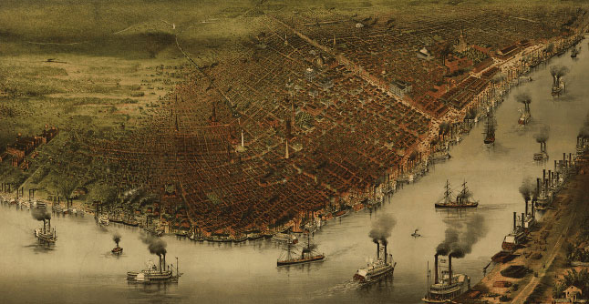
In the 1880's, Currier & Ives, the printmaking company that was the Google Maps of its day, dispatched an artist to record a panoramic vista of New Orleans. The drawing shows a thriving port city - steamboats, church spires and all - whose populace clung to the elevated areas near the Mississippi.
There were few settlements in the flood-prone lowlands to the north. The swamps to the east were not deemed worthy of illustrating.
It is not easy to broach the idea of such a smaller-scale city. The people here have long defied the perils of this place, whether that meant the yellow fever outbreaks of the 1800's or Hurricane Betsy in 1965.
"New Orleans has survived for 300 years," said Councilwoman Cynthia Hedge-Morrell.
But for much of that time, wasn't the city settled largely on the elevated areas?
"You are underestimating the intelligence of the people of New Orleans," Ms. Hedge-Morrell replied. "They know what they are doing."
|
- bill 12-11-2005 7:21 pm